We finally started our ride back to
Arkansas. This is formally Leg-2 Day-1 of our TAT adventure. The two previous
days were just local rides but we had a great time as described in my previous
posts.
Day-1 Statistics:
184 miles
9 hours
20 mph average
Lake City, CO to
Cotopaxi, CO
We planned an early departure knowing
we had 180+ miles to ride and not a lot of knowledge about road conditions or
any potential difficult areas. I had researched all the passes I knew we would
ride through and they all appeared to be no problem: more details later.
Everyone got up at 5 am and the flurry
of activity began. We had to pack our personal gear and get all bags out of the
cabin so Terry could close it down properly. We also started gearing up
expecting to depart as soon after sunrise as possible. At the same time “The
Judge” was preparing breakfast burritos for the whole group. It’s hard to call
this an adventure with this kind of support team but we are loving it.
We gathered for a group picture then
mounted up and rode out of Lake City to connect with the TAT about 10 miles out
of town at the top of Slumgullion Pass. The map below shows our ride in bold
red. The light red circle at the left is our Engineer Pass, Stony Pass and
Cinnamon Pass rides the previous two days. The light red track on the right is
the TAT track for tomorrow.

All I can say was the weather was
perfect with only a few sprinkles later in the day. We left Lake City at 7 am
and arrived at the motel 5 miles outside of Cotopaxi around 4 pm. We had
expected a 11 to 12 hour ride but the roads were so perfect we made it in 9
hours including rest stops, fuel and talking to other TAT riders. It must be
remembered we are riding opposite the normal flow from east to west. I lost
track of how many we passed but it was 10 to 20 at least. A few were in groups
but mostly solo riders. One larger group was from New Zealand and was
interesting to talk with. We would be riding through a forest and all of a sudden
a fast moving adventure bike with lots of bright lights would come from the
other direction, give a wave and speed off in the opposite direction. One
curious fact was almost all of them were heavy adventure bikes with lots of
bags and panniers. How they made it up some of the roads we’ve seen the last
couple of days is something I’d like to know. We haven’t seen anyone on smaller
dual-sports except for our group.
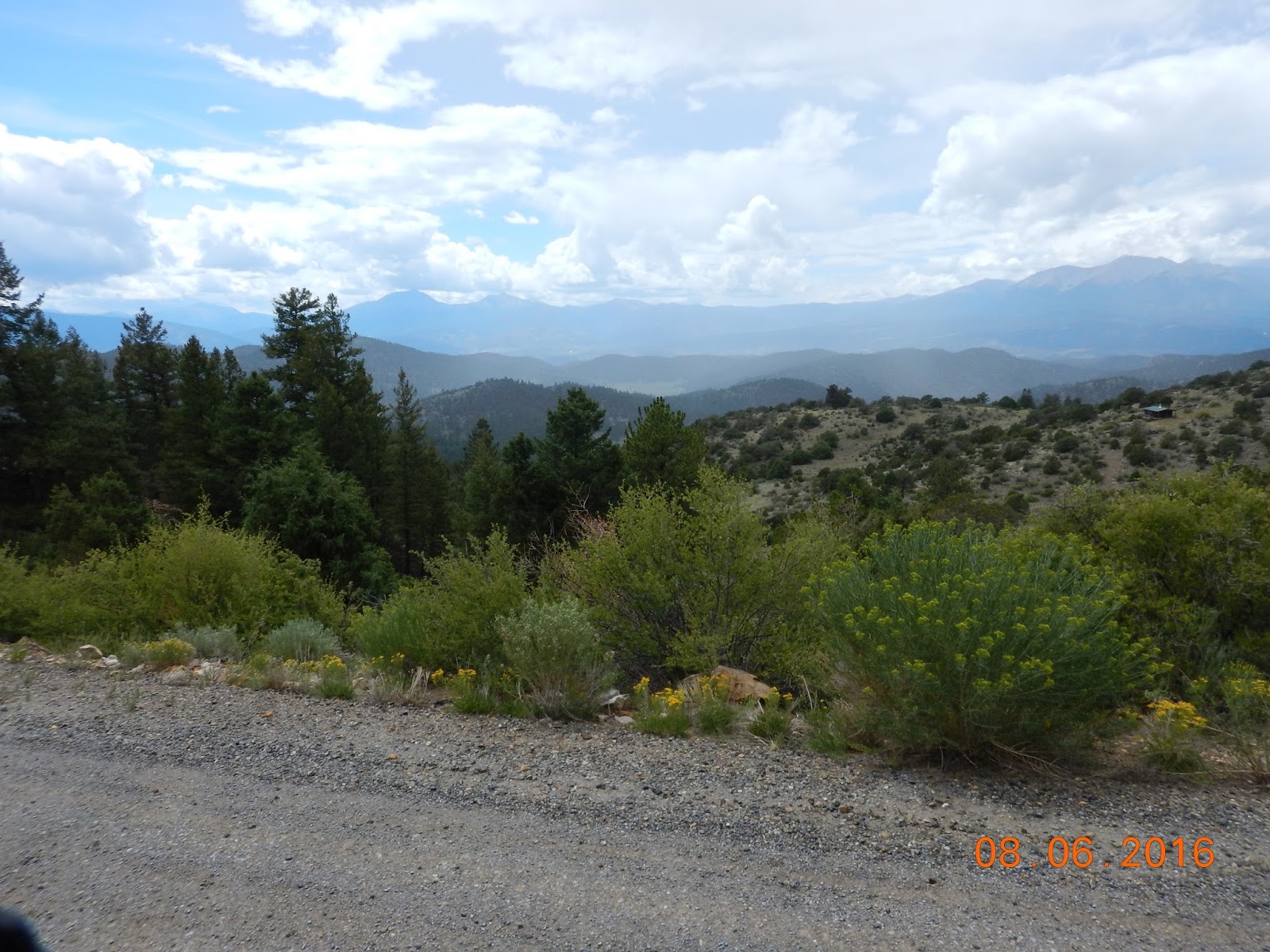
Roads from Lake City to Cotopaxi are
EXCELLENT with a few exceptions. These are the best roads we have encountered
on the TAT. Mostly hard packed sand/gravel and only a few small water crossings
that were easy to ride through at the current water level. Some fantastic
scenery on this stretch and I had to stop many times when I would come upon
something special. The pictures below do not do justice to what we saw.
The only exception was on Marshall
Pass. We rode west to east and the climb up Marshall Pass was no problems with
good roads. After reaching the top there were several different roads that led
down the mountain and it took a few tries to find the right one. This is where
the fun began. It reminded me of some of the Stony Pass roads that were full of
baby head rocks. This road was similar but a path through could usually be
found until we reached one section about 50 feet long that was nothing but baby
heads and larger rocks that were all loose on the ground. We all made it
through but the bikes were dancing all over the place. Coming up this road
would be interesting to say the least. Other than that the riding was fun with
lots of turns and ups and downs.
We had no bike incidents or injuries
today but everyone is worn out and ready to hit the sack especially since we
have a longer day tomorrow. “The Judge” fixed steaks for everyone tonight so we
are eating better than any other multi-day bike ride I’ve ever been on.
Tomorrow we ride from Cotopaxi to
Trinidad, CO; 199 miles. If the weather holds and the roads are anything like
the ones we saw today we should make it in about 10 hours. We leave a 6 am so
this has to be a short post.
One other item. As we entered the road
to start up Los Pinos Pass we found a sign saying NO motorcycles or ATVs. We
talked about it and decided we were all on licensed vehicles and this is a
county road so we went anyway. We have to assume it meant unlicensed
motorcycles but beware. No one stopped us.
BTW Cotopaxi is a very small spot on
the road. No cell service or Wi-Fi so I won’t post this until tomorrow night at
Trinidad. Enjoy the pics below:


No comments:
Post a Comment